Hydrologic Projects
ESPAM2 Recharge Tools 1.5 Documentation
ESPAM2 Recharge Tools - Toolbox
See Installing ESPAM2 Recharge Tools for instructions on installing the ESPAM Utilities toolbox into ArcGIS Toolbox.
The ESPAM Utilities toolbox is broken down into two toolsets: Build Files and Utilities. The Build Files toolset contains the tools that generate the output files that will then be used in the ESPAM Model. The Utilities toolset is intended to contain tools for data pre-processing, and utilities for working with the settings.ini file.
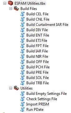
The ESPAM Utilities toolbox
Each tool attempts to load default files into the tool dialog using settings from the settings.ini file (See: Settings File for details.). At the top of each dialog is a drop-down menu that allows the user to choose which profile to load settings from out of the settings.ini file. If the user chooses a different profile, then the data entry fields will be automatically updated with the correct paths. ArcToolbox will perform some data validation to ensure that a file exists on disk, and that the file has the appropriate fields.
Build Files Toolset
All tools that generate output files to MKMOD will be in this toolset. Expand the sections below for details.
Build CEL File Tool
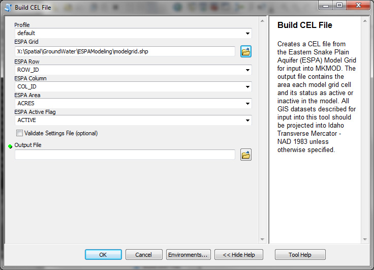
Creates a CEL file from the Eastern Snake Plain Aquifer (ESPA) Model Grid for input into MKMOD. The output file contains the area each model grid cell and its status as active or inactive in the model. [1]
- Takes the following inputs:
Corresponding Command Line Tool: Building CEL File
Build CNL File Tool
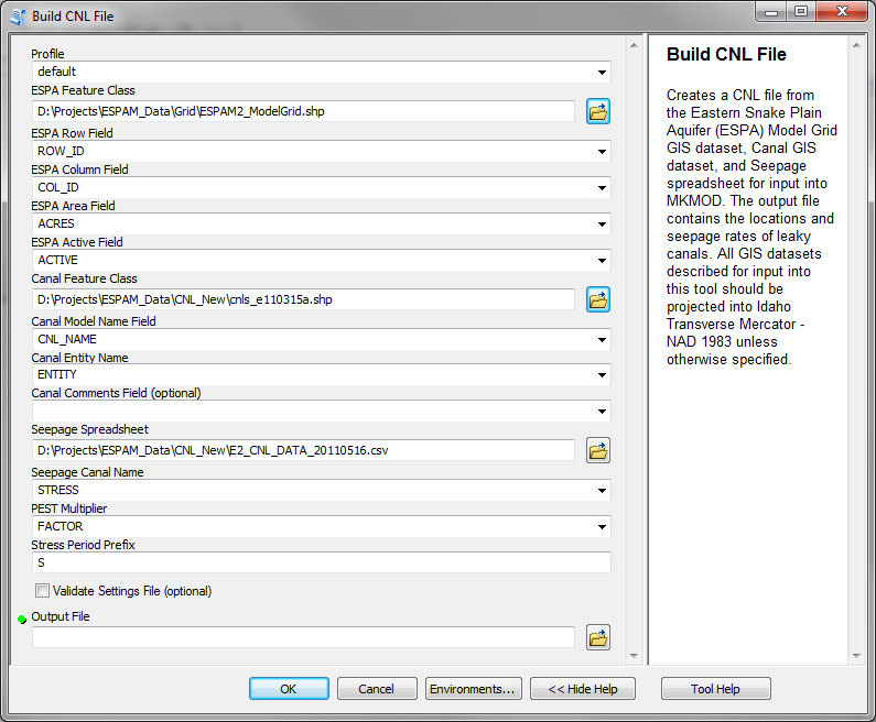
Creates a CNL file from the Eastern Snake Plain Aquifer (ESPA) Model Grid GIS dataset, Canal GIS dataset, and Seepage spreadsheet for input into MKMOD. The output file contains the locations and seepage rates of leaky canals. [1]
- Takes the following inputs:
Corresponding Command Line Tool: Building CNL File
Build DIV File Tool
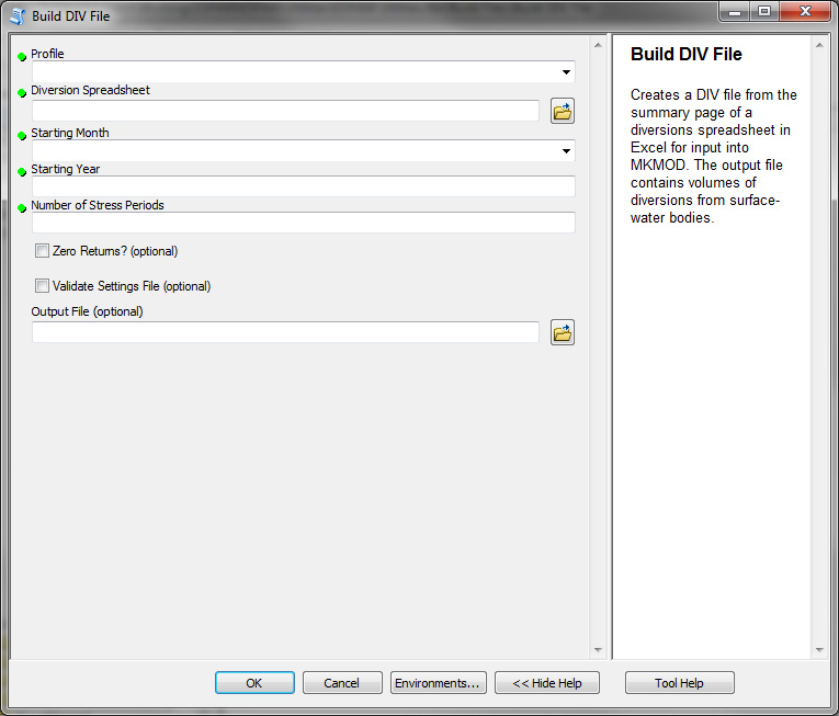
Creates a DIV file from the summary page of a diversions spreadsheet in Excel for input into MKMOD. The output file contains volumes of diversions from surface-water bodies.
- Takes the following inputs:
- Diversion Spreadsheet
- Month / Year representing first stress period
- Number of stress periods
Corresponding Command Line Tool: Building DIV File
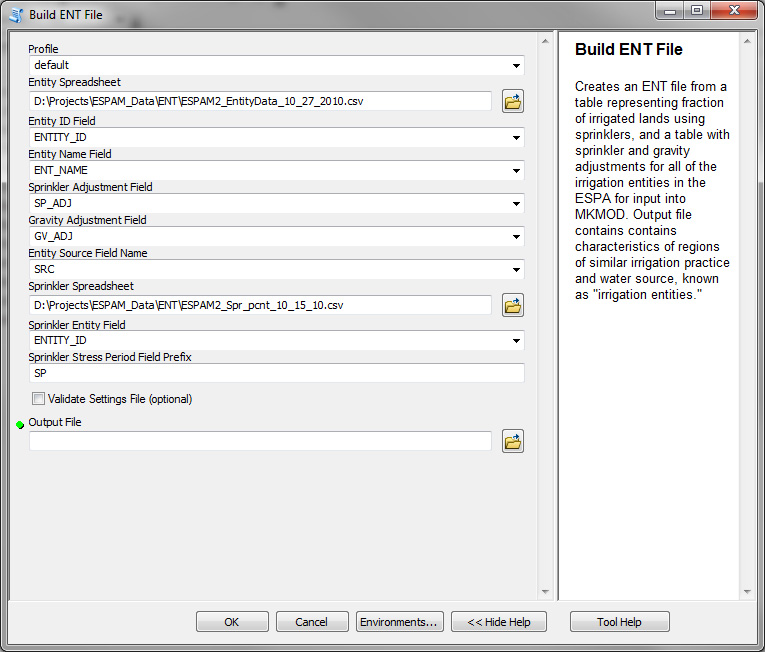
Build ENT File Tool
Creates an ENT file from a table representing fraction of irrigated lands using sprinklers, and a table with sprinkler and gravity adjustments for all of the irrigation entities in the ESPA for input into MKMOD. Output file contains contains characteristics of regions of similar irrigation practice and water source, known as “irrigation entities.”
- Takes the following inputs:
Corresponding Command Line Tool: Building ENT File
Build ETI File Tool
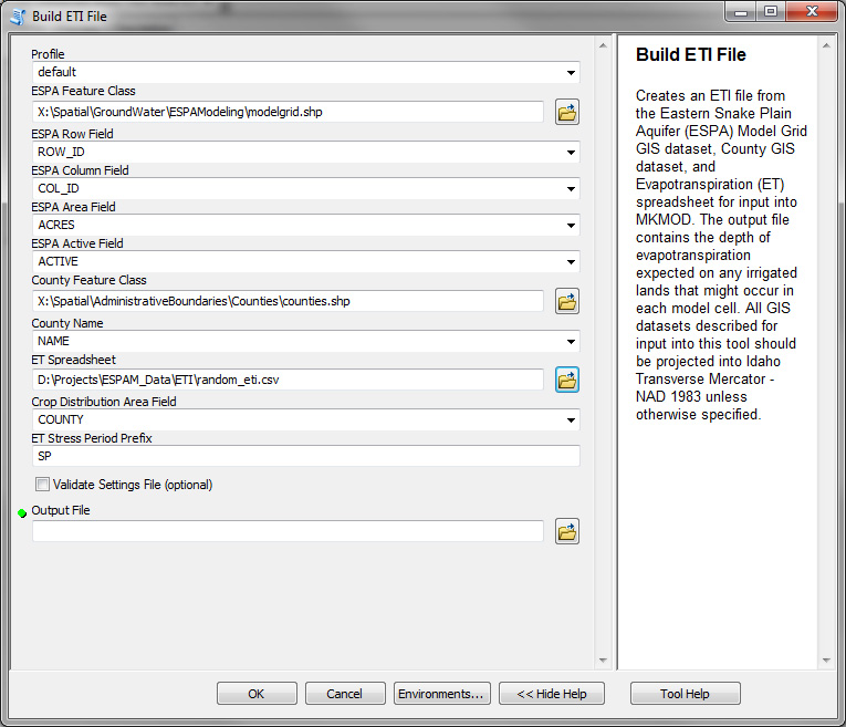
Creates an ETI file from the Eastern Snake Plain Aquifer (ESPA) Model Grid GIS dataset, County GIS dataset, and Evapotranspiration (ET) spreadsheet for input into MKMOD. The output file contains the depth of evapotranspiration expected on any irrigated lands that might occur in each model cell. [1]
- Takes the following inputs:
Corresponding Command Line Tool: Building ETI File
Build FPT File Tool
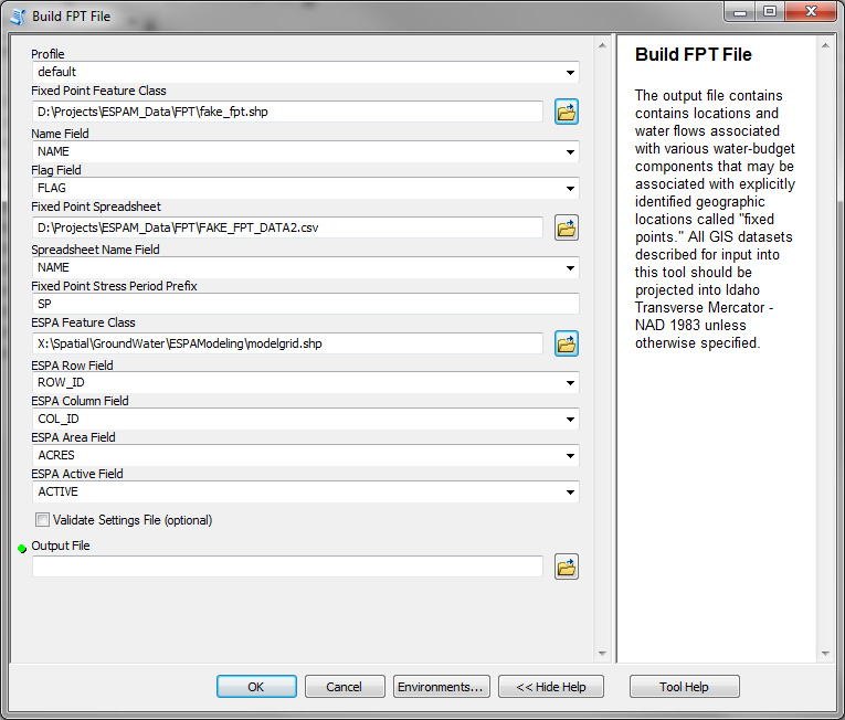
The output file contains contains locations and water flows associated with various water-budget components that may be associated with explicitly identified geographic locations called “fixed points.” [1]
- Takes the following inputs:
Corresponding Command Line Tool: Building FPT File
Build IAR File Tool
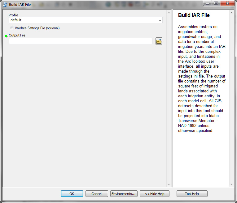
Assembles rasters on irrigation entities, groundwater usage, and data for a number of irrigation years into an IAR file. The output file contains the number of square feet of irrigated lands associated with each irrigation entity, in each model cell. [1]
Note
Due to the complex input, and limitations in the ArcToolbox user interface, all inputs are made through the settings.ini file.
- Takes the following inputs (in the settings.ini file only):
Corresponding Command Line Tool: Building IAR File
Build Curtailment IAR File Tool
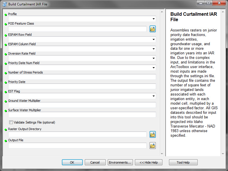
Assembles rasters on junior priority date fractions, irrigation entities, groundwater usage, and data for a number of irrigation years into an IAR file [1]. The output file contains the number of square feet of junior irrigated lands associated with each irrigation entity, in each model cell, multiplied by a user-specified factor. The user must select multipliers for groundwater and surface water irrigated lands. For a typical curtailment scenario, multipliers of -1 for groundwater irrigated lands and zero for surface water irrigated lands will be appropriate.
Note
Due to the complex input, and limitations in the ArcToolbox user interface, most inputs are made through the settings.ini file.
- Takes the following inputs (in the settings.ini file only):
- Takes the following additional inputs outside of the settings.ini file:
- Number of Stress Periods
- Priority Date
- EST Flag
- Groundwater Multiplier
- Surface Water Multiplier
Corresponding Command Line Tool: Building Curtailment IAR File
Build NIR File Tool
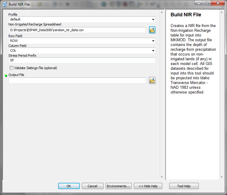
Creates a NIR file from the Non-Irrigation Recharge table for input into MKMOD. The output file contains the depth of recharge from precipitation that occurs on non-irrigated lands (if any) in each model cell. [1]
- Takes the following inputs:
Corresponding Command Line Tool: Building NIR File
Build OFF File Tool
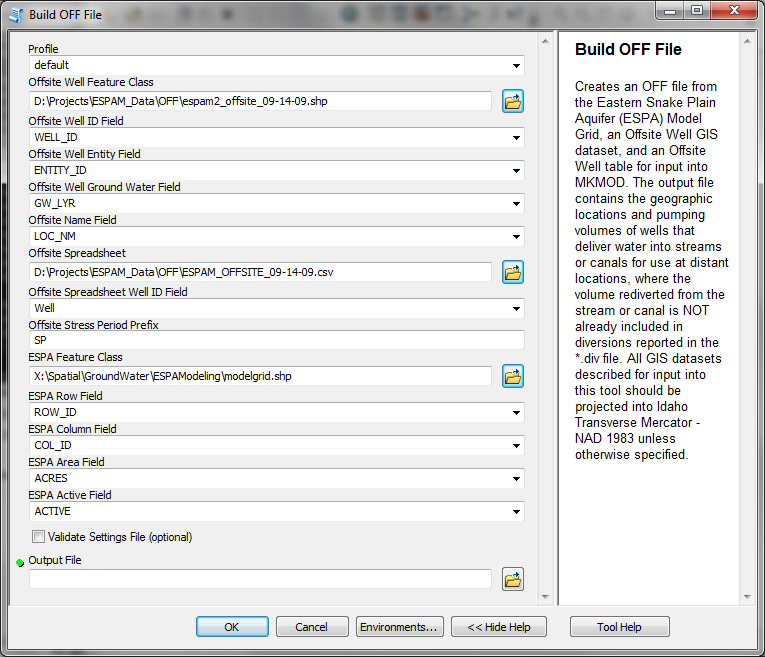
Creates an OFF file from the Eastern Snake Plain Aquifer (ESPA) Model Grid, an Offsite Well GIS dataset, and an Offsite Well table for input into MKMOD. The output file contains the geographic locations and pumping volumes of wells that deliver water into streams or canals for use at distant locations, where the volume rediverted from the stream or canal is NOT already included in diversions reported in the *.div file. [1]
- Takes the following inputs:
Corresponding Command Line Tool: Building OFF File
Build PCH File Tool
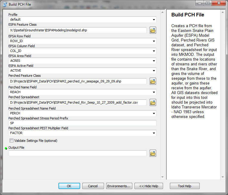
Creates a PCH file from the Eastern Snake Plain Aquifer (ESPA) Model Grid, Perched Rivers GIS dataset, and Perched River spreadsheet for input into MKMOD. The output file contains the locations of streams and rivers other than the Snake River, and gives the volume of seepage from these to the aquifer, or gains these receive from the aquifer. [1]
- Takes the following inputs:
Corresponding Command Line Tool: Building PCH File
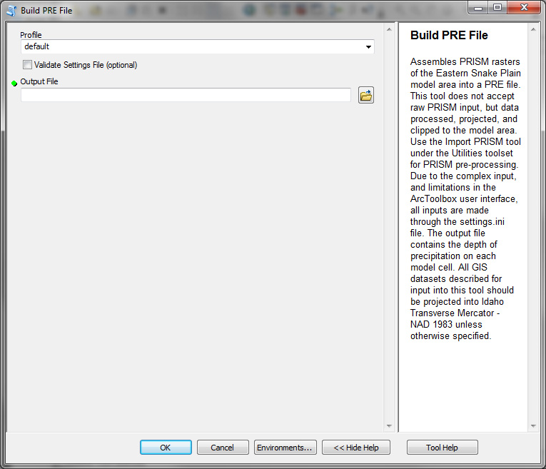
Build PRE File Tool
Assembles PRISM rasters of the Eastern Snake Plain model area into a PRE file. This tool does not accept raw PRISM input, but data processed, projected, and clipped to the model area. Use the Import PRISM tool under the Utilities toolset for PRISM pre-processing. The output file contains the depth of precipitation on each model cell. [1]
Note
Due to the complex input, and limitations in the ArcToolbox user interface, all inputs are made through the settings.ini file.
- Takes the following inputs (in the settings.ini file only):
Corresponding Command Line Tool: Building PRE File
Build SOL File Tool
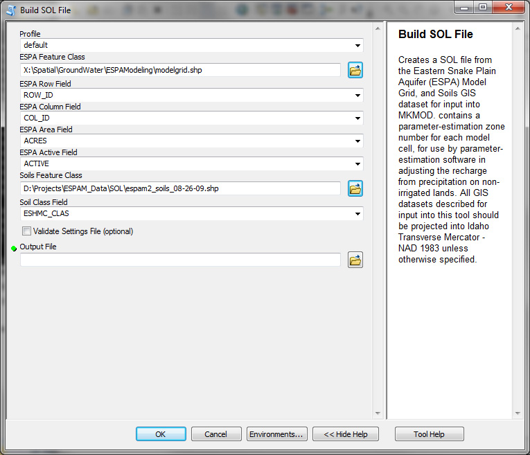
Creates a SOL file from the Eastern Snake Plain Aquifer (ESPA) Model Grid, and Soils GIS dataset for input into MKMOD. contains a parameter-estimation zone number for each model cell, for use by parameter-estimation software in adjusting the recharge from precipitation on non-irrigated lands. [1]
- Takes the following inputs:
Corresponding Command Line Tool: Building SOL File
Build TRB File Tool
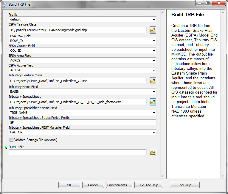
Creates a TRB file from the Eastern Snake Plain Aquifer (ESPA) Model Grid GIS dataset, Tributary GIS dataset, and Tributary spreadsheet for input into MKMOD. The output file contains estimates of subsurface inflow from tributary valleys into the Eastern Snake Plain Aquifer, and the locations where those flows are represented to occur. [1]
- Takes the following inputs:
Corresponding Command Line Tool: Building TRB File
Utilities Toolbox
Expand the sections below for details.
Import PRISM Tool
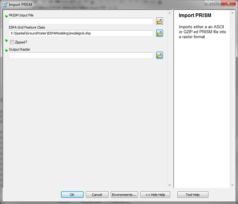
Imports a file downloaded from the PRISM website at Oregon State University. See PRISM Pre-Processing Steps for processing details.
- Corresponding Command Line Tool: Building PRISM Inputs
Build Empty Settings File
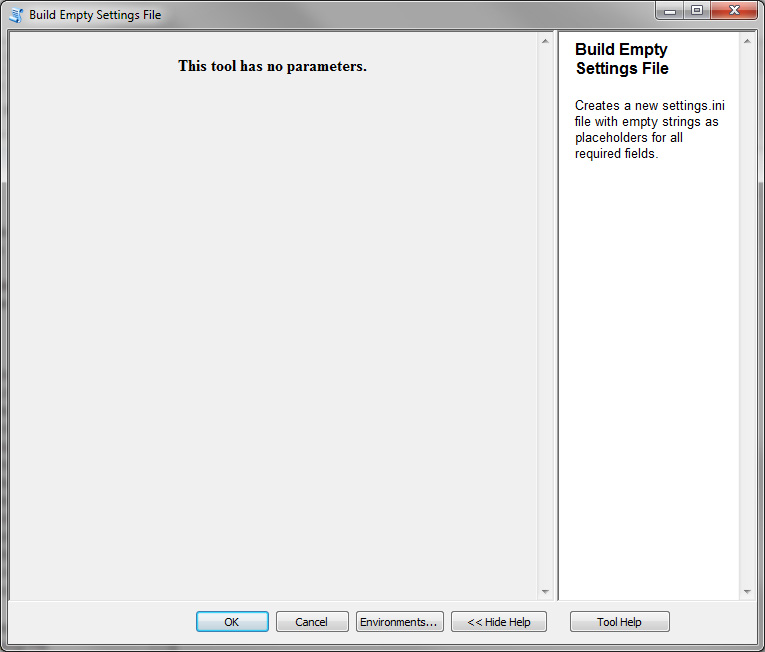
Generate an empty settings file with empty strings as place holders. Save settings file to %APPDATA%\ESPAM\settings.ini directory. This tool takes no parameters, and will only generate a file if the file does not already exist.
Check Settings File
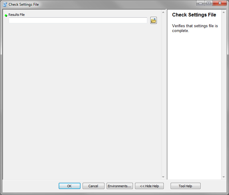
Verifies that the settings file located %APPDATA%\ESPAM\settings.ini has all of the correct sections defined and is structured correctly.
PDate Tool
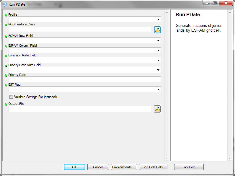
Generate fractions of junior lands by ESPAM grid cell.
- Takes the following inputs:
| [1] | (1, 2, 3, 4, 5, 6, 7, 8, 9, 10, 11, 12) All GIS datasets described for input into this tool should be projected into Idaho Transverse Mercator - NAD 1983 unless otherwise specified. See Map Projections Used By ESPAM2 Recharge Tools for details. |
 Official Government Website